01 / SURFACE REFERENCE
GNSS + heading
The vessel establishes the global position and heading reference for the subsea navigation chain.

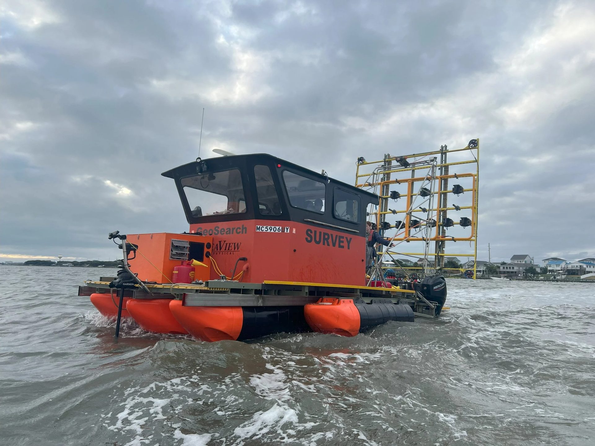
SeaView Geophysical designs, builds and operates purpose-built platforms that deliver Advanced Geophysical Classification of unexploded ordnance and cable-burial assessment in the shallow, cluttered waters where conventional survey stops.
A short presentation on SeaView Geophysical's background, the principle of Advanced Geophysical Classification for UXO detection, our deployment options for the Marine UltraTEM IV, and how we plan an underwater AGC project.
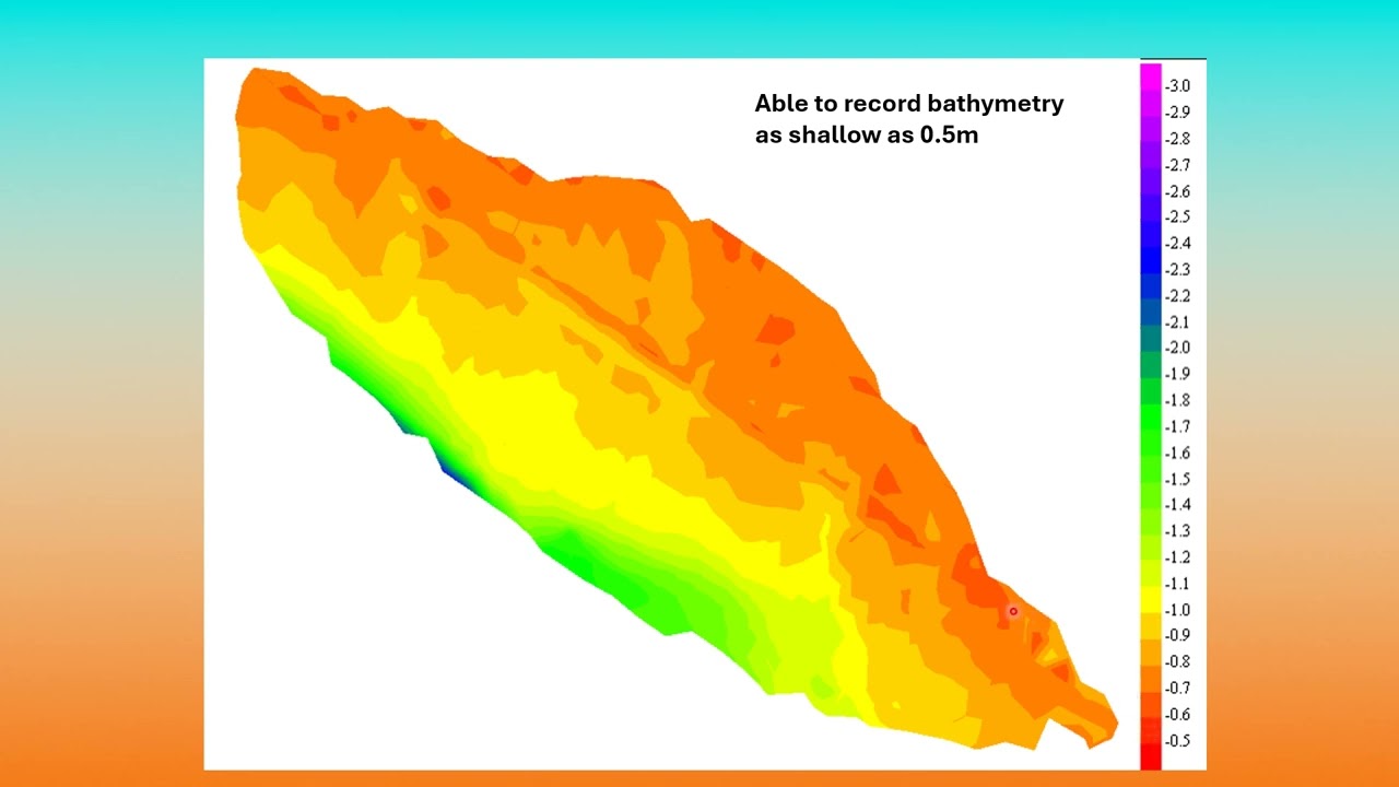
Every AGC line starts with a precise picture of the bottom. We run simultaneous swath bathymetry and 3D side-scan, then use that map to route the array around every rock, snag and obstruction the survey reveals.
One pass. Co-registered bathymetry, 3D side-scan and full water-column imagery — the same map that keeps a half-metre standoff safe.
Shallow, cluttered water is punishing on conventional sonar: surface reflections and multipath wreck the data exactly where we need it cleanest. The Ping DSP 3DSS-DX-450's patented processing rejects that interference and resolves targets in the water column independent of the seabed — so obstacles and proud ordnance show up before the AGC array ever gets near them.
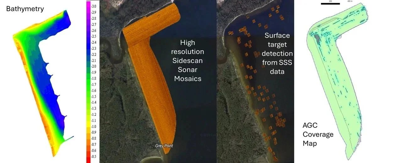
Pole-mounted from Geosound, our shallow-draft acoustic survey skiff, the 3DSS-DX-450 is a dual-axis 3D side-scan sonar that returns swath bathymetry, 2D side-scan and true 3D imagery from a single pass — the most versatile hydrographic sonar for the water we work in.
Manufacturer specifications. Actual performance varies with sound velocity profile, survey geometry, seabed type and operating conditions.
The vessel establishes the global position and heading reference for the subsea navigation chain.
Acoustic measurements connect the surface reference to the submerged survey array and provide surface-referenced underwater position and heading.
Inertial navigation and bottom-referenced Doppler velocity maintain smooth motion information between acoustic position updates.
The integrated navigation solution supports positioning of the UWAGC sensor and the data it collects below the GNSS horizon.
For SeaView's deeper-water operations, Subsonus extends the surface GNSS reference to the submerged survey system, providing acoustic position and heading through the water column.
SPRINT-Nav Mini adds tightly integrated inertial and Doppler velocity measurements to maintain a smooth, high-rate navigation solution while tracking movement relative to the seafloor.
Subsonus provides the array's surface-referenced acoustic position. SPRINT-Nav Mini strengthens continuity and motion between acoustic updates — a more robust navigation architecture for UWAGC, ROV and subsea survey operations.
One survey area can run from a beach, through a weed bed and a navigation channel, out into open swell. No single tool covers all of it — so we built one for each.
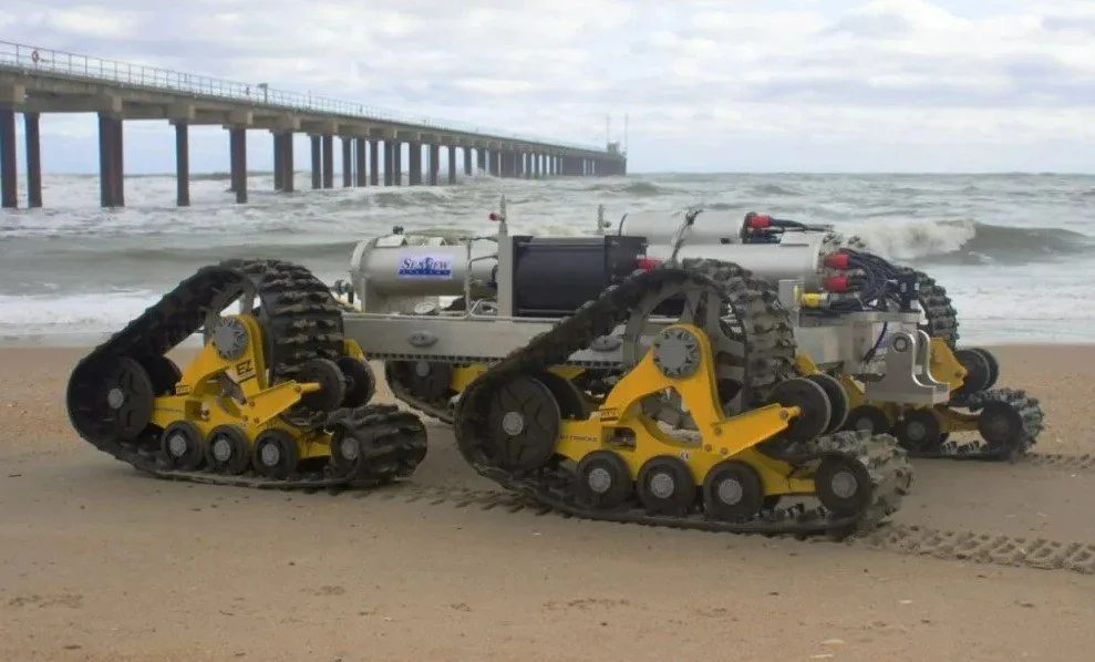
A tracked crawler that tows the AGC array straight through breaking surf — the one zone no boat can survey — on a mast stable enough for precise positioning.
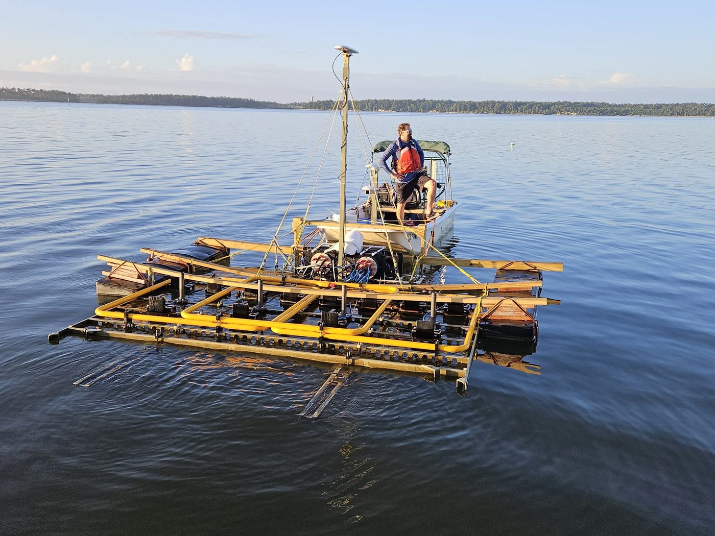
Where thrusters foul on weed, an air-drive shunts the floating array while GeoSearch stands off and records the data over an RF link.
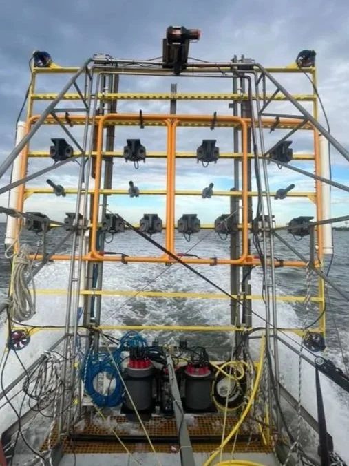
A 3.6 m swath array holding ~0.5 m altitude on its own thrusters. With Subsonus USBL positioning it now classifies from 0.8 m down to 25 m — lifting over charted obstacles and dropping back with minimal missed area.
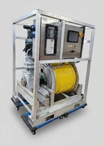
In 2 m swell the winch pays cable in and out in sync with the vessel's heave, keeping the deep-tow array unperturbed just off the seabed for cable-burial assessment.
Every SeaView platform exists to do one thing well: position and collect quality AGC data in an environment that changes by the metre.
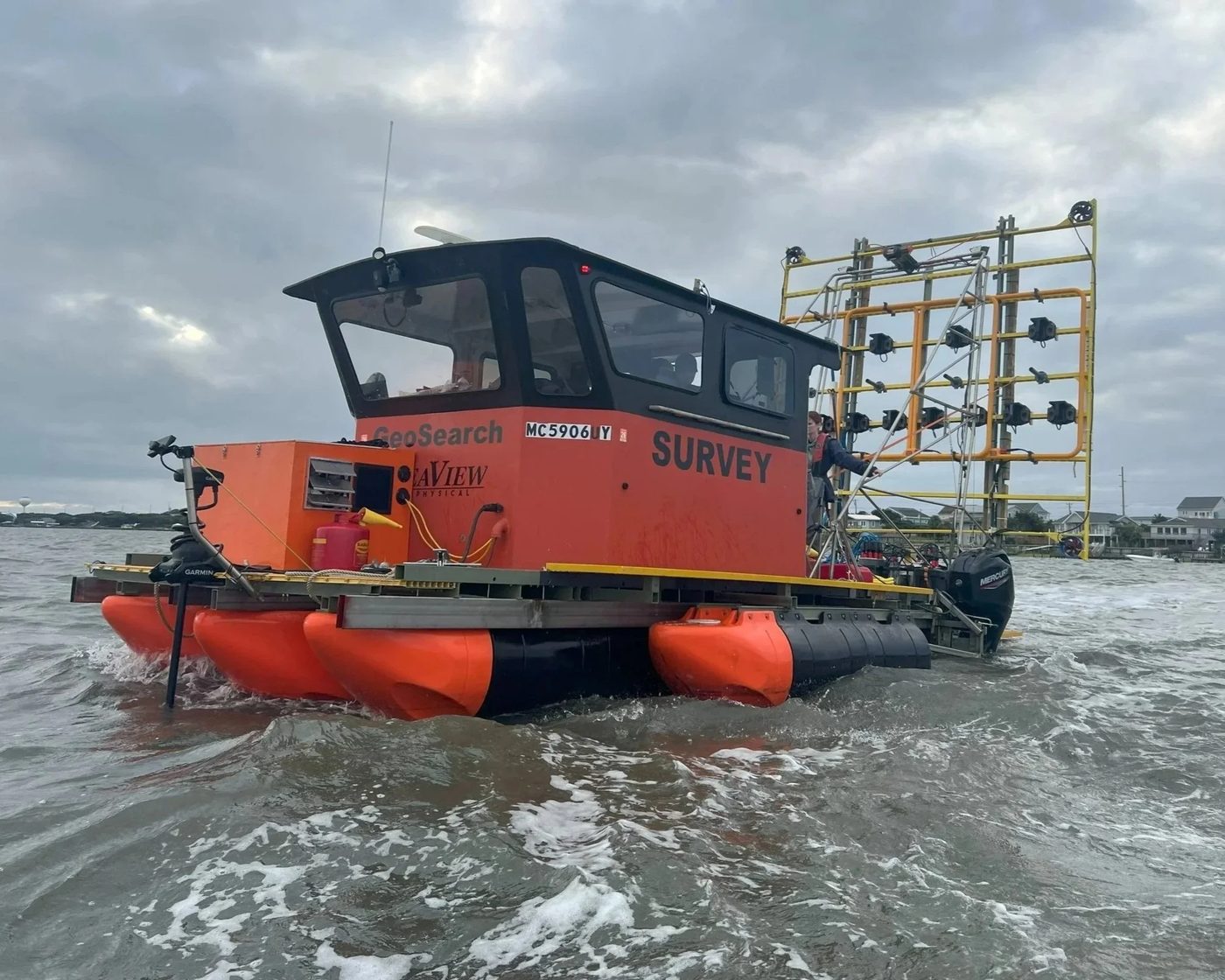
A shallow-draft survey vessel purpose-built to carry and deploy the 3.6 m Active Towed Array in as little as 0.8 m of water. Station-keeping, clean power, Starlink and a sheltered work environment have backed the collection of over 300 acres of survey-grade, fully documented AGC data.
The towed array is built for broad acreage — but some targets sit where a rigid tow simply can't go: beneath wharfs and piers, tight against bridge pilings, or in and around collapsed structures. The AGC ROV is our answer. Fully maneuverable and pilot-flown, it carries the AGC sensor into those obstructed, no-go pockets and holds standoff where the array can't follow. With a 2 m swath it trades width for control — turning the cluttered margins of a survey into classified ground instead of data gaps.
3.6 m swath, thruster-stabilized to hold ~0.5 m altitude and clear charted obstacles on the fly. Now positioned by Subsonus USBL for classification from 0.8 m down to 25 m.
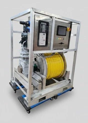
In-house COTS-driven system that keeps a deep-tow array steady off the seabed through open swell. Light and fast to mobilize on a vessel of opportunity.
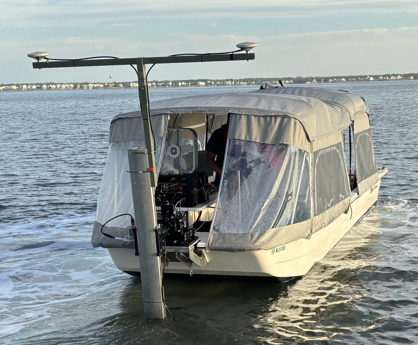
Our acoustic survey skiff — a very-shallow-draft 24 ft Carolina Skiff running the Ping DSP 3DSS-DX-450 to collect simultaneous 3D side-scan and swath bathymetry in water as shallow as 0.7 m — the map every AGC line is built on.
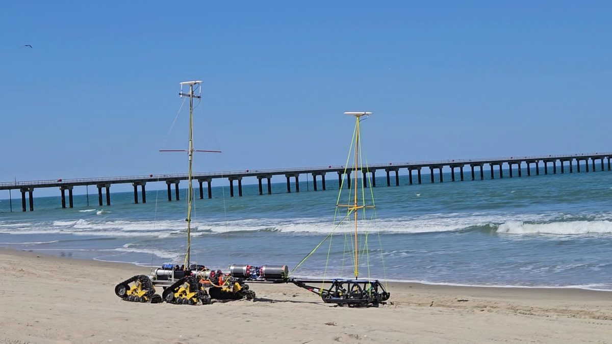
A tracked platform stable enough to tow an array through the surf zone and carry a tall positioning mast where no vessel can go.
An air-drive that shunts the floating array through weed-choked shallows while GeoSearch records over RF from nearby.
The purpose-built vessels, sonar and ROV systems we developed for munitions response transfer directly to coastal engineering and marine infrastructure — wherever a precise picture of the seabed, and what's buried in it, drives the decision.
Munitions detection and classification ahead of dredging, offshore-wind foundations and subsea-cable routes — clearing the footprint before the work begins.
Post-construction depth-of-burial and exposure surveys that confirm cables and pipelines stay protected — and pinpoint where they don't.
Single-beam, multibeam and side-scan bathymetry with ROV inspection for dredging programs, channel maintenance and dam-safety assessments.
Underwater Advanced Geophysical Classification and Digital Geophysical Mapping across estuarine shorelines for CH2M HILL / Jacobs, in support of a NAVFAC Navy CLEAN project — including a 95-acre shallow-water survey in 6″ to 7 ft of water.
Sub-contract to Black Tusk Geophysics on ESTCP MR24-8267, demonstrating UltraTEM deployment from shore to surf (SurfROVer), nearshore (Active Towed Array) and open water (Heave-Compensated Winch).
SVG-proposed ESTCP MR26-A1-9470: setting and positioning Instrument Verification Strips and QC seeds in deeper water. Contracting expected Q2 2026, demonstrations from summer 2027.
The same systems shown above are the systems SeaView mobilizes in the field. Shallow draft, controlled array altitude, acoustic subsea positioning and platform changes are part of one operating method—not separate demonstrations.




SeaView Geophysical is an active, SAM.gov-registered small business — set up to contract directly with federal agencies and to integrate quickly with accredited prime contractors on Military Munitions Response Program (MMRP) work.
Drop us a line or give us a call and we'll work with you to refine a method that meets your needs — from the surf zone to open ocean.